
Documents > Publications
For publications relating to a specific excavation, please see our Dig History page.
Member publications
Con Ainsworth (1917-2001) Recollections
Con was an influential member of WAS from 1963 to his death in 2001. 100 years after Con was born, this is a collection of members recollections celebrating his life as an Archaeologist in Sussex.
Con was an influential member of WAS from 1963 to his death in 2001. 100 years after Con was born, this is a collection of members recollections celebrating his life as an Archaeologist in Sussex.
|
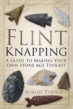
Flint Knapping: A Guide to Making Your Own Stone Age Toolkit
Robert Turner Flint knapping, which is the shaping of flint or other fracturing stone to manufacture tools, was one of the primary skills used for survival by our prehistoric ancestors. Bob's guide contains everything you need to know on the subject, accompanied by illustrations and photographs. |
Who was Madame Jadot?
Peter H. Skilton
An investigation into the history of a 1942 grave in the Roman Catholic cemetery , Angmering, West Sussex.
Peter H. Skilton
An investigation into the history of a 1942 grave in the Roman Catholic cemetery , Angmering, West Sussex.
|
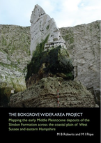
The Boxgrove Wider Area Project
M B Roberts & M I Pope Mapping the early Middle Pleistocene deposits of the Slindon Formation across the coastal plain of West Sussex and eastern Hampshire. The Boxgrove site is one of the most important localities in the world for studying the archaeology, geology and palaeoenvironments of the Lower Palaeolithic, during the early Middle Pleistocene. The Boxgrove Wider Area Project recorded the surviving marine and terrestrial sediments of the Slindon Formation, which contain the Palaeolithic in situ land surfaces, over an east-west distance of 26km between Westbourne and Arundel, 15.5km of which has the potential to preserve archaeological material in a sedimentary sequence similar to that at the Boxgrove site. Available for purchase from University College London for £30 |
Field Walking at Mouse Lane, Steyning, West Sussex
Judie English
Report on field walking at Charlton (Steyning) conducted in late August / early September 2019. The geography and history of the site is described and finds analysed, including Bronze Age pottery, Romano-British material, Saxo-Norman pottery and Medieval material.
Judie English
Report on field walking at Charlton (Steyning) conducted in late August / early September 2019. The geography and history of the site is described and finds analysed, including Bronze Age pottery, Romano-British material, Saxo-Norman pottery and Medieval material.
Friends publications
Roman Villas in Sussex a Cartographic Conundrum
Anthony Brook
An examination of the research on distribution of Roman villas in Sussex.
Anthony Brook
An examination of the research on distribution of Roman villas in Sussex.
David Millum, Streat Medieval Pottery Kilns Resurrected - September 2020
A retrospective report on an unpublished community excavation of three medieval pottery kilns and ancillary pits at Marchants Farm, Streat, East Sussex conducted under the directorship of Con Ainsworth between 1979 and 1983. The report has been compiled from brief field notes, photographs and plans with the assistance of reminiscences from some of the volunteers who helped on the project. Given the incomplete, and at times conflicting, information and the loss of most of the finds in the intervening 30 years, this paper can only provide an outline of the excavation and its findings. Hopefully it will promote the inclusion of the Streat site in future research in medieval pottery production and distribution in Sussex. This will be greatly assisted by the analysis of the surviving pottery assemblage by Luke Barber which defines the main fabrics and stylistic characteristics of the pottery that can be reasonably allocated as products from this site.
A retrospective report on an unpublished community excavation of three medieval pottery kilns and ancillary pits at Marchants Farm, Streat, East Sussex conducted under the directorship of Con Ainsworth between 1979 and 1983. The report has been compiled from brief field notes, photographs and plans with the assistance of reminiscences from some of the volunteers who helped on the project. Given the incomplete, and at times conflicting, information and the loss of most of the finds in the intervening 30 years, this paper can only provide an outline of the excavation and its findings. Hopefully it will promote the inclusion of the Streat site in future research in medieval pottery production and distribution in Sussex. This will be greatly assisted by the analysis of the surviving pottery assemblage by Luke Barber which defines the main fabrics and stylistic characteristics of the pottery that can be reasonably allocated as products from this site.
Chichester and District Archaeology Society, Reports on Investigations at Petworth
Worthing Archaeological Society members were involved in the work on some of these reports.
Worthing Archaeological Society members were involved in the work on some of these reports.
- Steve Cleverly, Trevor Davies and Mike Kallaway, Petworth Sports Field Geophysical Survey – October 2019
- Petworth House Pleasure Gardens, Petworth Trial Trench Investigations – October 2019
- Petworth North Garden Geophysical Survey – October 2018
- Petworth North Garden Doric Temple Geophysical Survey – October 2018
David Lea, Judie English and Richard Tapper, 2019, South Downs Cross Ridge Dyke Project Part 5: River Arun to the A286/Lavant Valley
This is the fifth in a series of interim reports for the South Downs Cross Ridge Dyke Project, each report covers separate sections of the downs as the project progresses. This report covers the area from the River Arun westwards to the A286, the road that routes across the downs from Midhurst to Chichester. This report highlights the similarities to and differences from the previous areas surveyed. The practice of constructing cross-dykes on the spurs projecting from the down thus displaying to those approaching from the Weald continues. The main differences are an increase in the number of areas of high ground encompassed by cross-dykes and the grouping of a number of cross-dykes in close proximity.
This is the fifth in a series of interim reports for the South Downs Cross Ridge Dyke Project, each report covers separate sections of the downs as the project progresses. This report covers the area from the River Arun westwards to the A286, the road that routes across the downs from Midhurst to Chichester. This report highlights the similarities to and differences from the previous areas surveyed. The practice of constructing cross-dykes on the spurs projecting from the down thus displaying to those approaching from the Weald continues. The main differences are an increase in the number of areas of high ground encompassed by cross-dykes and the grouping of a number of cross-dykes in close proximity.
David Lea, Judie English and Richard Tapper, 2018, South Downs Cross Ridge Dyke Project Part 4: River Adur to River Arun
This report covers the section of the project between the rivers Adur and Arun. The area is divided by the Findon valley, a present and potentially prehistoric overland route from the coastal plain across the Downs to the Weald. To the east of the Findon valley the cross-dykes appear to limit access to high ground, to the west of the valley the cross-dykes cut across the ridge and spurs acting as obstacles to east/west transit. As with previous areas investigated visibility to the cross-dykes from either the rivers or the Weald appear to be a factor for many of the dykes.
This report covers the section of the project between the rivers Adur and Arun. The area is divided by the Findon valley, a present and potentially prehistoric overland route from the coastal plain across the Downs to the Weald. To the east of the Findon valley the cross-dykes appear to limit access to high ground, to the west of the valley the cross-dykes cut across the ridge and spurs acting as obstacles to east/west transit. As with previous areas investigated visibility to the cross-dykes from either the rivers or the Weald appear to be a factor for many of the dykes.

|
Michael J. Allen (Ed.) - Molluscs in Archaeology: methods, approaches and applications
Oxbow Books, Oxford and Philadelphia, 2017 This the first book of its type to include both land and marine shells. This book introduces you to land snails and marine shells - showing what snails and shells can do for you. Environment economy, diet, trade, artefacts from UK to the Med. The subject of ‘Molluscs in Archaeology’ has not been dealt with collectively for several decades. This new volume in Oxbow’s Studying Scientific Archaeology series addresses many aspects of molluscs in archaeology. It will give the reader an overview of the whole topic, both methods of analysis and approaches to interpretation. It aims to be a broad-based text book giving readers an insight into how to apply analysis to different present and past landscapes, and how to interpret those landscapes. It includes marine, freshwater and land snail studies, and examines topics such as diet, economy, climate, environment and land-use, isotopes and molluscs as artefacts. It aims to provide archaeologists and students with the first port of call giving them a) methods and principles, and b) the potential information molluscs can provide. It concentrates on analysis and interpretation most archaeologists and students can undertake and understand, and reviews the ‘heavier’ science in terms of potential, application and interpretational value. In conjunction with the Conchological Society of Great Britain & Ireland. |